| | Hafan Home | | | | Chwilio Search | | | | Hanes a dogfennau History & records | | | | Mapiau Maps |
|
Arolwg Ordnans 1", Hen Gyfres |
Ordnance Survey 1", Old Series |
|
Cyhoeddwyd map cyfres gyntaf yr Arolwg Ordnans un fodfedd o Ogledd Sir Aberteifi (dalen 59) yn 1837, ar sail arolygon a gwnaethpwyd yn 1833-4. Fe ddaeth adargraffiadau niferus dros y degawdau dilynol, yn cynnwys newidiadau bach o dro i dro. Yn ystod y 1840au ychwanegwyd symbolau daearegol i'r platiau, ac o'r 1860au ymddangosodd y rheilffyrdd. |
 |
The first edition of the O.S. 1" to the mile map for North Cardiganshire (sheet 59) was published in 1837, based on surveys in 1833-34. Numerous reprints followed over the following decades, with minor alterations and additions being made from time to time. In the 1840's geological symbols were added to the plates, and from the 1860's the new railways appeared. |
Rhanfapiau ar y safleTynnir y delweddau yma o fapiau gwreiddiol o'r 1840au neu 1850au. Torrwyd y tudalen mewn wyth rhan, tua maint A4 yr un, wedi'u mowntio ar liain. Mae'r tudalen wedi'i drimio i'r ymyl, felly nad oes manylion argraffu ar gael. Mae dau ranfap ar y safle. Sganiwyd y ddau ar 300 dpi, arbed fel ffeiliau JPEG lliw 24-bit, a chywasgu tipyn. |
Extracts on the siteThe images we have here are taken from originals of the 1840's or 50's. The sheet has been split into 8 parts, approx A4 size, and mounted on linen. The sheet has been trimmed to the margin, so no printing details remain. We have two extracts from the map on the site, both scanned at 300 dpi and saved as slightly compressed JPG files with 24-bit colour. |
|
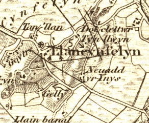
Mae'r rhanfap cyntaf yn cynnwys rhandir canolog y plwyf, a maint 735 x 553 pixels, tua dwy filltir i bob cyfeiriad. Maint y ddelwedd yw tua 134KB. |
 |
The first covers the central portion of the parish, and is 735 x 553 pixels, approx 2 miles in each direction. The image is 134KB in size. |
|
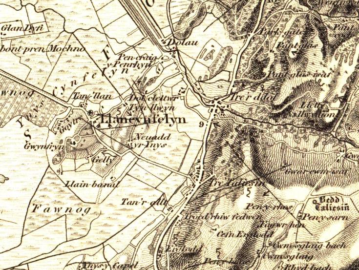
Mae'r ail ranfap yn cynnwys yr holl blwyf a'r ardal o'i amgylch, ac mae'n 2500 x 1670 pixels, tua 8 x 5.5 milltir. Maint y ddelwedd llawn yw 1.2MB! Tebyg y byddai'n syniad da i lwytho'r llun i lawr, yn hytrach nag edrych arno yn uniongyrchol.[De-cliciwch ar y dolen a dewis 'Save Link As...' (Netscape) neu 'Save Target As...' (Internet Explorer)] |
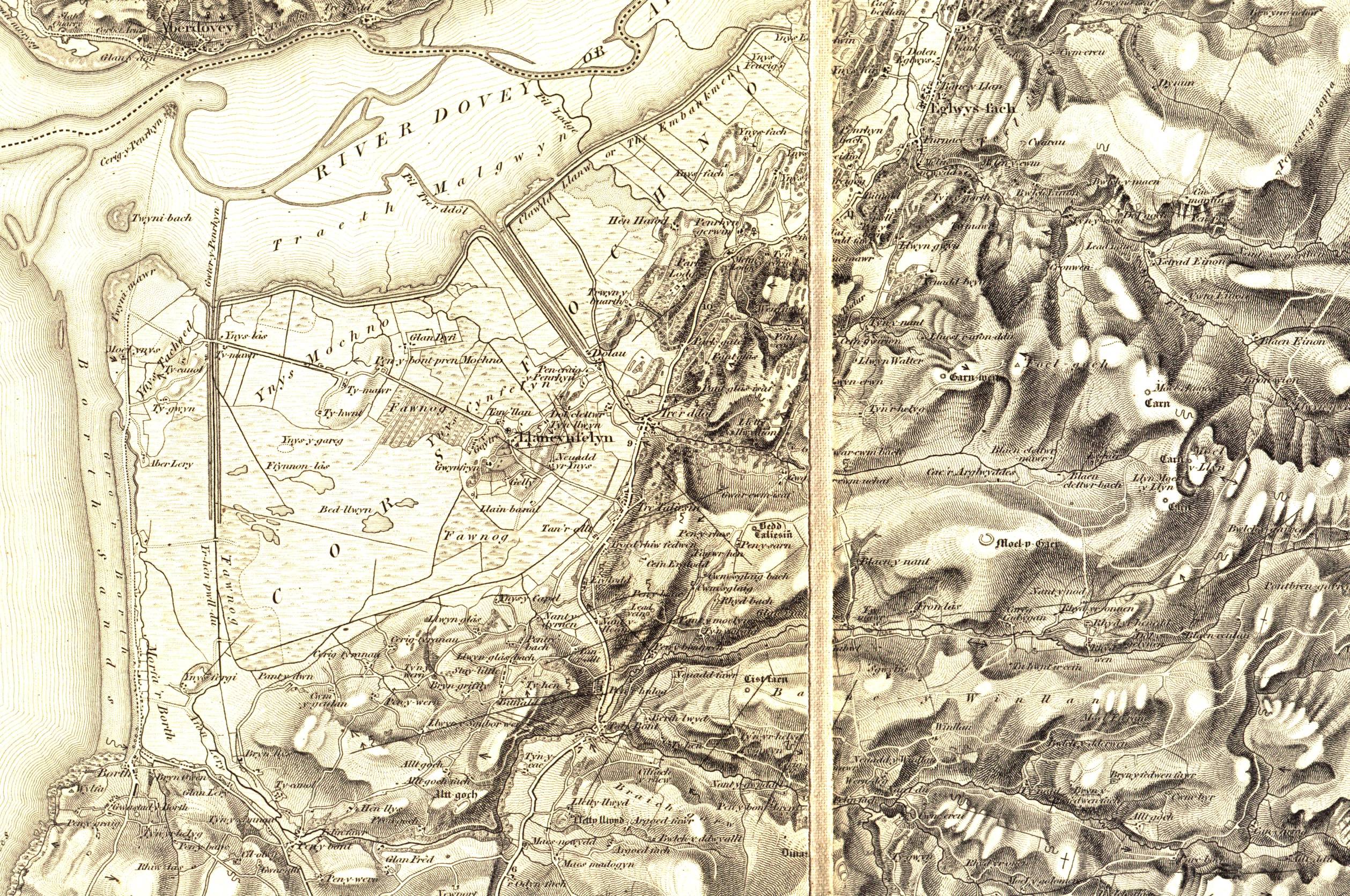 |
The second covers the whole parish and the surrounding area, and is 2500 x 1670 pixels, approx 8 x 5.5 miles. The full image is 1.2MB in size: it might be a good idea to download this, rather than viewing it directly.[Right click on the link, and choose 'Save Link As...' (Netscape) or 'Save Target As...' (Internet Explorer)] |
Rhanfapiau ychwanegol |
Further extracts |
|
|
Mae awduron y safle yn piau copïau'r tair tudalen y map 1", sy'n cynnwys sir Aberteifi oll (bron). Tasech chi am i ni sganio darn arbennig a'i anfon atoch drwy e-bost, cysylltwch â ni. |
Copies of all three sheets of the 1" map, covering almost the whole of Cardiganshire, are owned by the authors. If you would like us to scan a particular section and e-mail it to you, please contact us. |
|
Adargraffiadau modern |
Modern reprints |
|
|
Mae David a Charles wedi adargraffu mapiau 1" Hen Gyfres i Loegr a Chymru oll. Mae Llangynfelyn ar ddalen 39 (ISBN 0 7153 4620 2). Yr un map ag yr un sydd yma ydyw, i bob pwrpas, ond copïo o fersiynau wedi'i argraffu yn y 1890au. Mae'n cynnwys nodau manwl gan Dr J B Harley ar fersiynau gwahanol y map. |
The publishers David and Charles have re-printed the Old Series 1" maps for the whole of England and Wales. Llangynfelyn is covered by sheet 39 (ISBN 0 7153 4620 2). The map is basically the same as the one used here, but is copied from later printings in the 1890's. It includes detailed notes by Dr J B Harley on the different versions of the map. |
| Cwestiynau? Sylwadau? Beth ydych chi'n meddwl am y tudalen hwn a gweddill y wefan? Dywedwch yn y llyfr ymwelwyr. Questions? Comments? What do you think about this page and the rest of the site? Tell us in the guest book. |