| | Hafan Home | | | | Chwilio Search | | | | Hanes a dogfennau History & records | | | | Mapiau Maps |
|
|
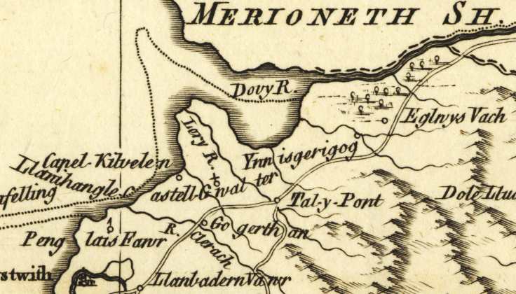
Rhan o fap (braidd yn wallus) o Sir Aberteifi yn England Illustrated, gan Thomas Kitchin, cyhoeddwyd gan J.Dodsley yn Llundain yn 1764. Maint y map yw tua 10 modfedd gan 7.5, a lluniwyd ar raddfa oddeutu 4.5 milltir i'r modfedd. Mae'r diffyg cywirdeb yn od, oherwydd cyhoeddodd map gwell gan Kitchin i'r London Magazine yn 1757 (copi ar Rootsweb). Defnyddiwyd y map hwn (di-enw) fel sail y map yn The New British Traveller gan George Walpoole yn 1784 (copi Rootsweb) |
Part of the (rather inaccurate) map of Cardiganshire in England Illustrated, by Thomas Kitchin, published by J.Dodsley in London in 1764. The map is about 10 inches by 7.5, drawn at a scale of about 4.5 miles to the inch. The lack of accuracy is curious as Kitchin had produced a more accurate one for the London Magazine in 1757 (copy at Rootsweb). This map was then used (anonymously) as the basis of the map in George Walpoole's The New British Traveller in 1784 (Rootsweb copy) |
| Cwestiynau? Sylwadau? Beth ydych chi'n meddwl am y tudalen hwn a gweddill y wefan? Dywedwch yn y llyfr ymwelwyr. Questions? Comments? What do you think about this page and the rest of the site? Tell us in the guest book. |