| | Hafan Home | | | | Chwilio Search | | | | Hanes a dogfennau History & records | | | | Mapiau Maps |
|
Mapiau O.S. 6 modfedd |
O.S. 6 inch maps |
|||
|
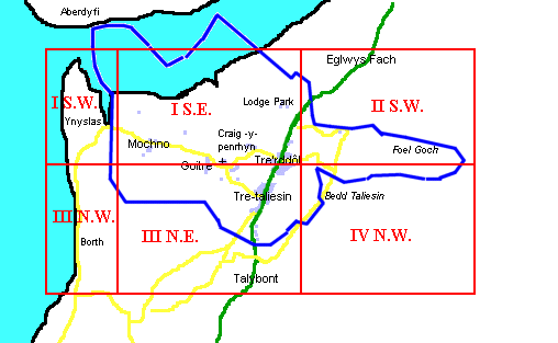
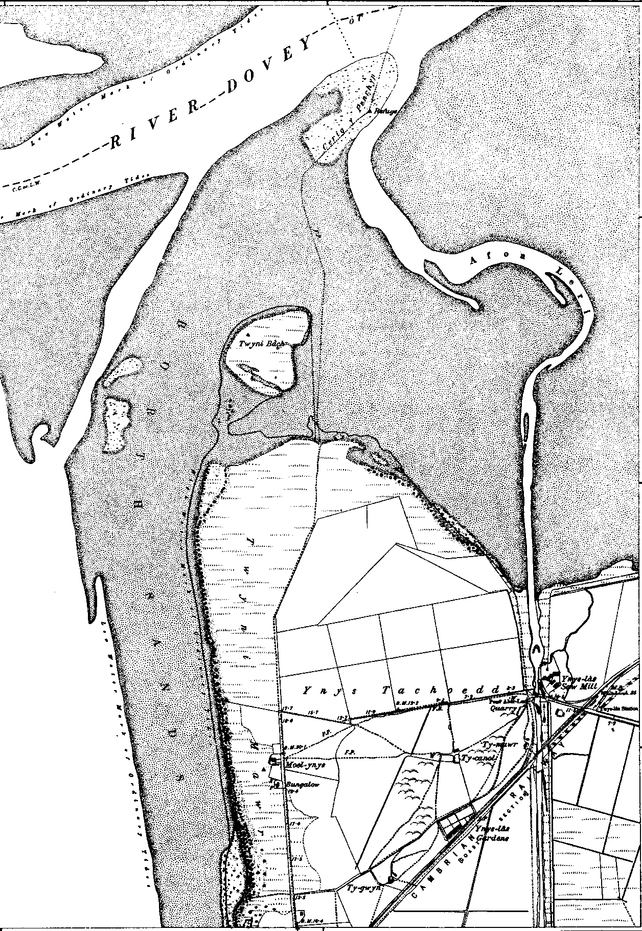
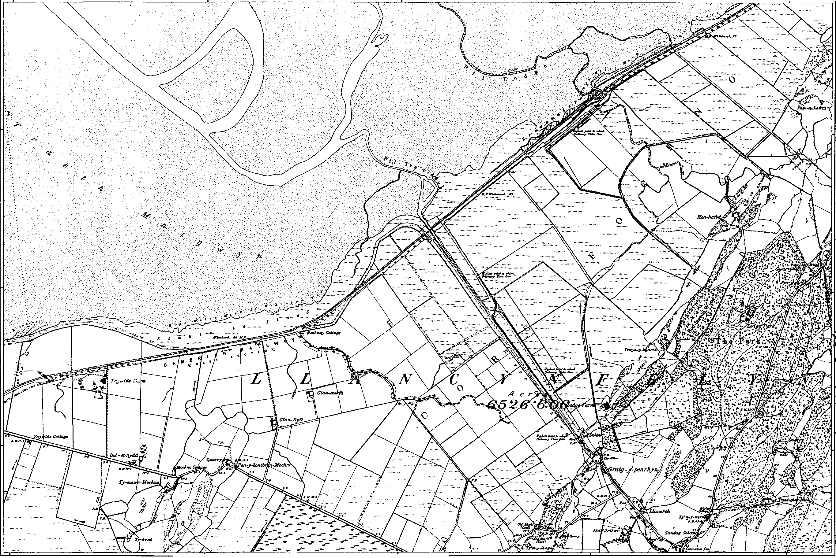
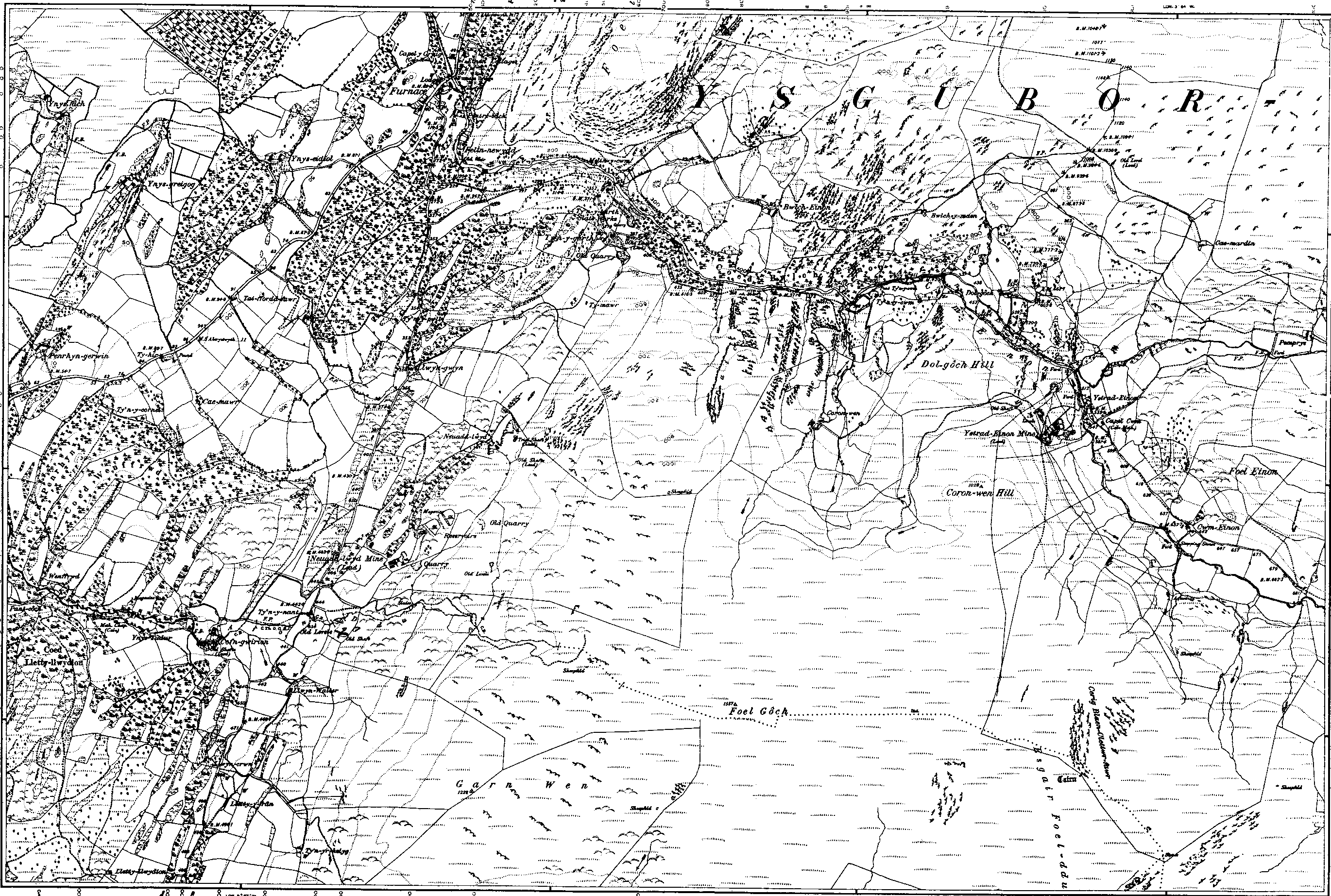
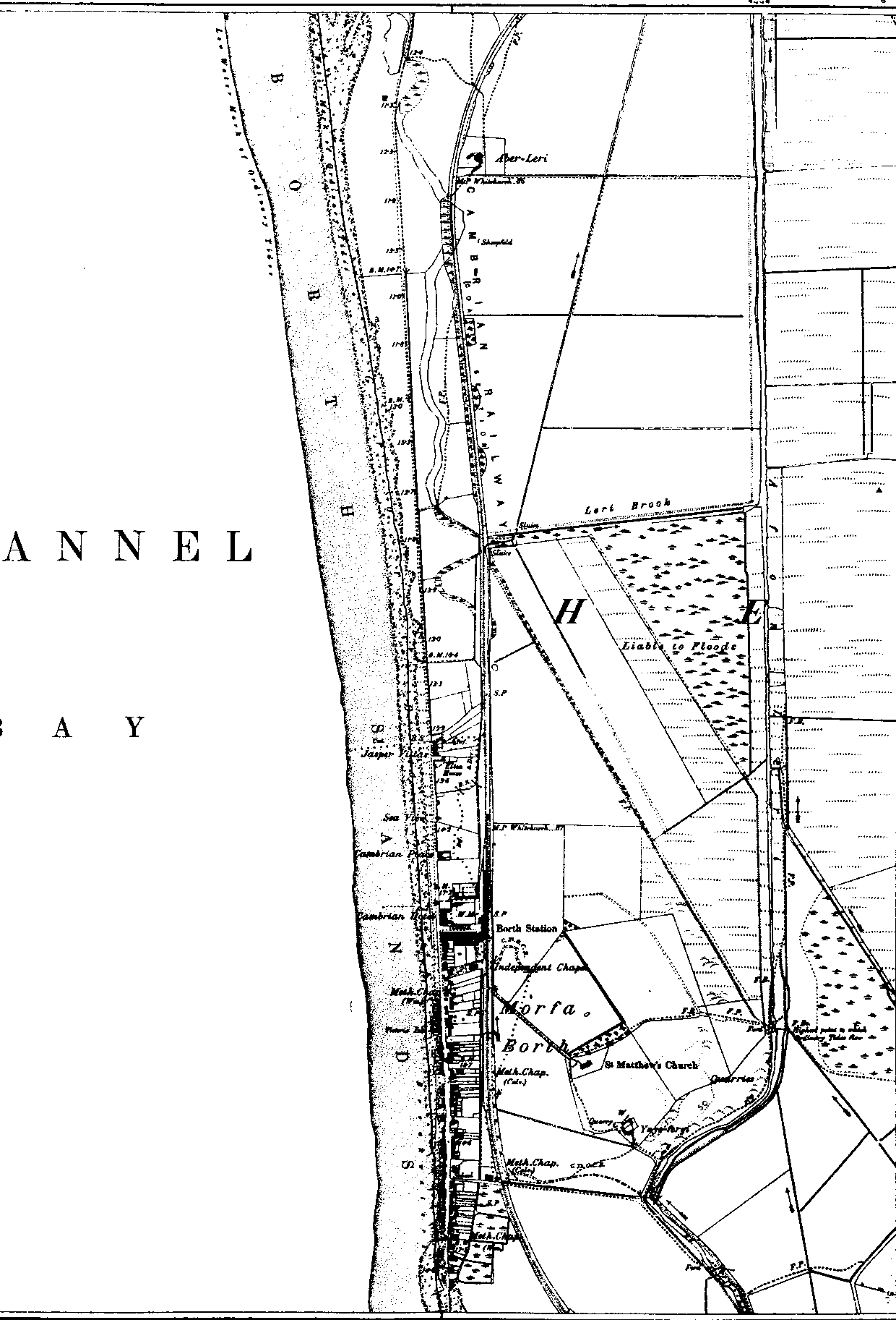
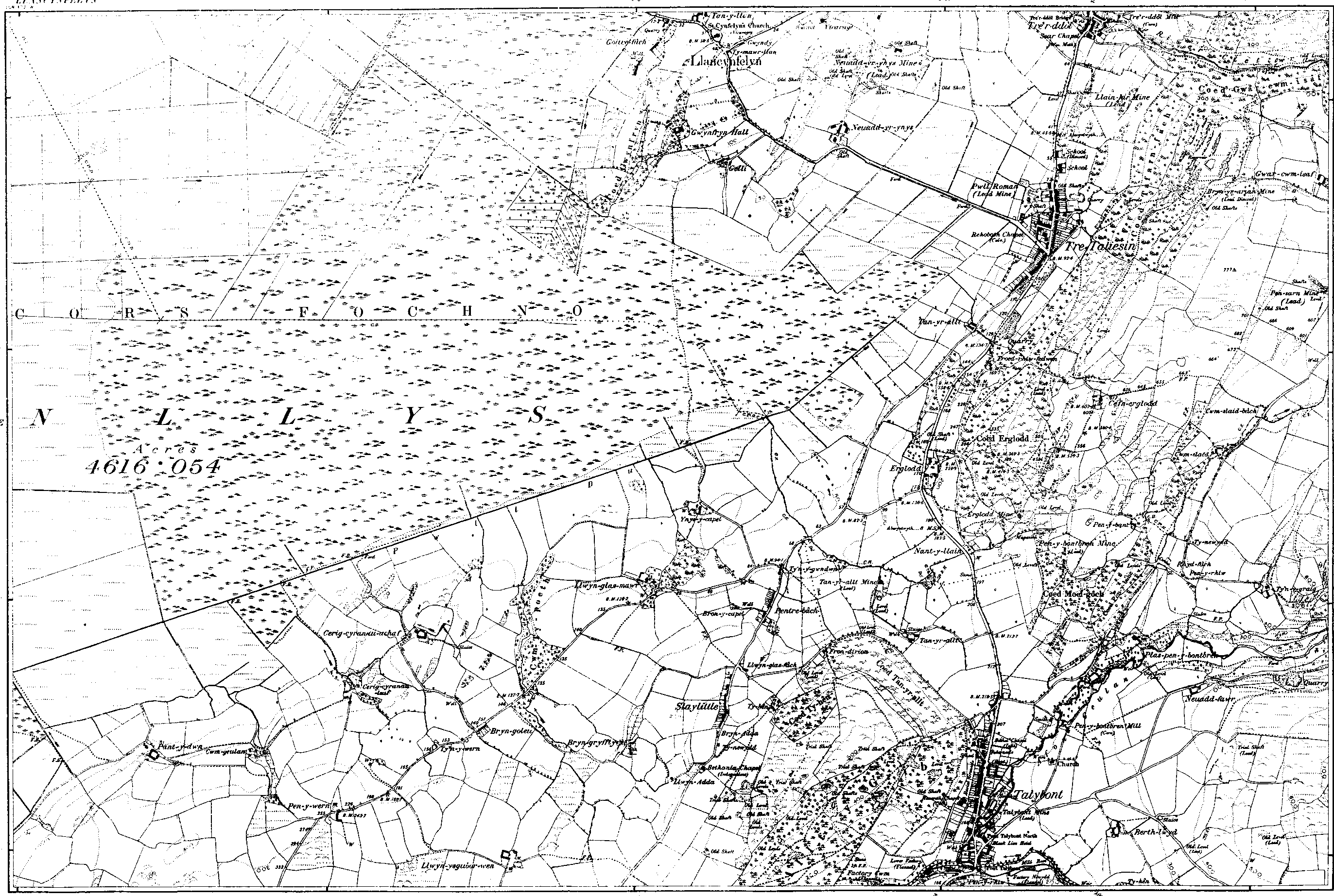
Seiliwyd cyfres mapiau yr O.S. 6-modfedd-i'r-filltir[1:10560] ar gyfres 1:2500. Gwnaethpwyd gwaith arolwg ir gyfres gyntaf yn Llangynfelyn yn 1886-7. Rydym wedi sganio mapiau y gyfres gyntaf (sy'n allan o hawlfraint nawr) ac rydym yn eu cynnig nhw yma fel dail llawn, yn hytrach na'u torri mewn rhannau, fel y gwneuthum gyda'r mapiau 1:2500. Maer holl blwyf ar bedair dalen, ond rydym wedi ychwanegu dwy ddalen rannol i estyn y map i'r gorllewin hyd at yr arfordir. Rydym wedi paratoi geiriadur daearyddol ('gazetteer') sy'n rhestri bob lle wedi'u henwi ar y map 6-modfedd. Mae hynny yn cynnig dolennau sy'n mynd yn syth ir lle priodol ar y map. Maint pob un ddalen yw 18 modfedd x 12 modfedd (hynny yw, 3 milltir x dwy filltir). Sganiwyd hwy ar gydraniad o 150 picsel/modfedd ac maent wedi'u cadw fel GIF dau-lliw. Felly 100 picsel ar eich sgrîn yw tua 200 llath ar y dir. RHYBUDD: Maint pob dalen llawn yw tua 250KB, felly rhaid i chi disgwyl oediad tra'n llwytho i lawr. Er mwyn gweld map naill ai ei dewis oddi ar y rhestr isod, neu cliciwch ar ran priodol y map. |
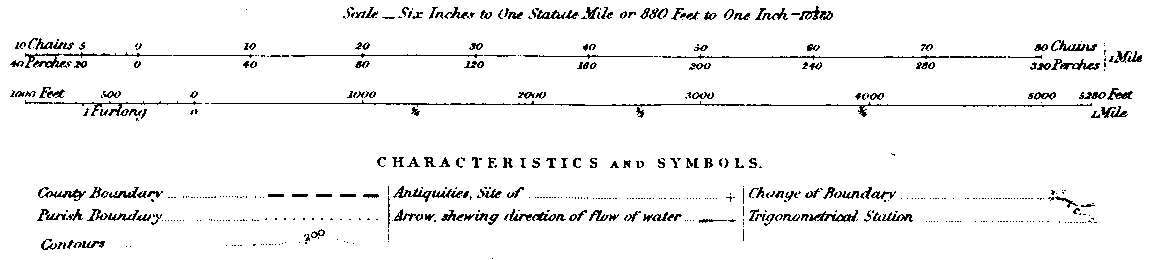
The Ordnance Survey 6-inch-to-one-mile (1:10560) series of maps was based on the 1:2500 series. The survey work for the first edition for Llangynfelyn was done in 1886-7. We have scanned the first series maps (which are now out of copyright) and present them here as complete sheets as they were first published, rather than breaking them into chunks as we have done for the 1:2500 series. The parish is covered by 4 main sheets: 2 other partial sheets have been added to extend te map to the west as far as the coast. We have prepared a gazetteer that lists all places named on the 6-inch map. This also provides links straight to the appropriate place on the map. Each sheet is physically 18 in. x 12 in. (i.e. 3 miles by 2 miles). They have been scanned at a resolution of 150 pixels/inch and stored as 2-colour GIF files. This means that 100 pixels on your screen is a little under 200 yards on the ground. WARNING: Each full sheet is approximately 250KBin size, so beware of long downloads! To view a map either select it by number from the list below, or click on the appropriate part of the map. |
 |
| Cwestiynau? Sylwadau? Beth ydych chi'n meddwl am y tudalen hwn a gweddill y wefan? Dywedwch yn y llyfr ymwelwyr. Questions? Comments? What do you think about this page and the rest of the site? Tell us in the guest book. |