| | Hafan Home | | | | Chwilio Search | | | | Hanes a dogfennau History & records | | | | Mapiau Maps |
|
|
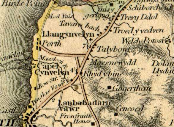
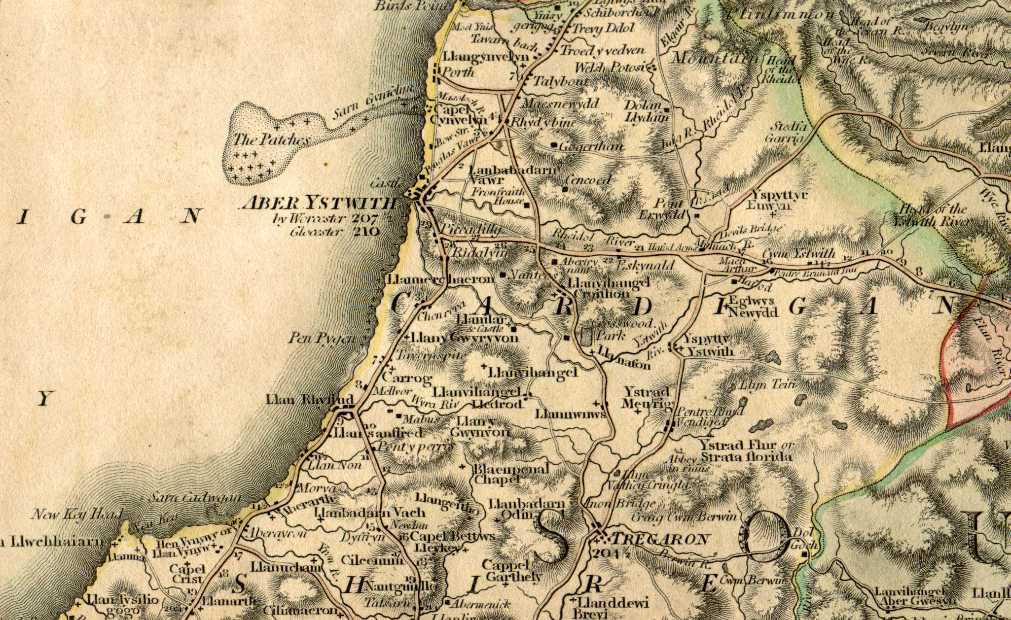
Rhan o fap o Gymru gyfan gan Charles Smith, cyhoeddwyd yn wreiddiol yn 172 Strand, Llundain, Ionawr 6ed 1804, fel rhan o "Smith's New English Atlas". Dyma copi o'r ail argraffiad, "Corrected to 1808". Parheuodd yr atlas mewn print gyda nifer o argraffiadau newydd hyd 1864. 'Roedd y map cymreig yn yr atlas ar ddwy ddalen, ond mae'r copi yma wedi'i mowntio ar lliain fel un dalen. Lluniwyd y map ar raddfa o dua 5.5 milltir i un fodfedd. Defnyddiwyd yr un map yn "The Scenery, antiquities and biography of South Wales" gan Benjamin Heath Malkin, Llundain, 1804. Mae darn fwy o Ogledd Ceredigion ar gael hefyd (461KB). Scaniwyd y fap ar 300 dpi. |
Part of a map of the whole of Wales by Charles Smith, originally published at 172 Strand, London, on January 6th 1804, as part of "Smith's New English Atlas". This is a copy of the second edition, "Corrected to 1808". The atlas continued in print, with a number of new editions, until 1864. The Welsh map in the atlas was on two sheets, but this copy has been mounted on linen as a single sheet. The map was drawn at a scale of about 5.5 miles to the inch. The map was also used in "The Scenery, antiquities and biography of South Wales" by Benjamin Heath Malkin, London, 1804. A larger extract of North Cardiganshire is also available (461KB). The map was scanned at 300dpi. |
| Cwestiynau? Sylwadau? Beth ydych chi'n meddwl am y tudalen hwn a gweddill y wefan? Dywedwch yn y llyfr ymwelwyr. Questions? Comments? What do you think about this page and the rest of the site? Tell us in the guest book. |